The History of Upper Teesdale
Millions of years ago tropical seas covered this area. Carboniferous sediments accumulated, leading to deposits of limestone and sandstones. A great band of whinsill rock, or dolerite, was formed from molten magma which was squeezed between layers of other rocks. As it cooled and solidified it became very hard, black columns. Minerals such as lead, zinc, barytes and fluorspar formed, creating the conditions for a future mining industry.
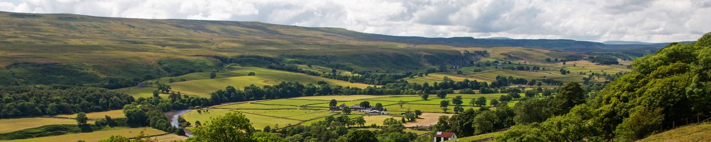
When the last ice age ended about 10,000 years ago, glaciers scoured the land as they melted, creating its dales. The whinsill withstood erosion, leaving the high sided gullies and waterfall ledges, such as High Force and Cauldron Snout, that you see today. Geotrails leaflets are available from The AONB visitor centre at Bowlees or downloadable here.
Plants colonised the area and forests grew. The first humans, nomadic hunters, came to the dale about 8,000 years ago. Farming developed, probably influenced by the trade route that brought new ideas and the flints vital for hunting and clearing land. One stone axe found here had come all the way from Cornwall.
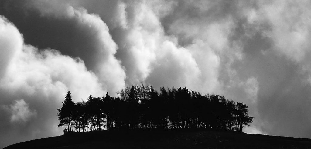
Trees gradually disappeared from the upper dale and fields were enclosed by the stone walls, creating scenery similar to what you see now. A notable landmark is the pine-topped hill of Kirkcarrion that overlooks Lunedale and Middleton. The mount is said to house the grave of a Brigantian Prince called Caryn – the Welsh-Celtic name ‘Carreg Caryn’ meaning ‘Caryn’s burial heap’. The Brigantes were one of the self-governing, independent tribes occupying the north of England during the Iron Age.
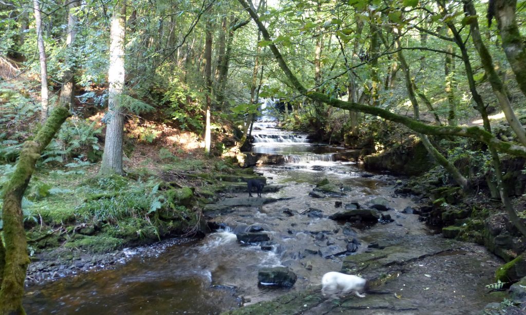
The Romans built forts nearby but not in the upper dale and there is no evidence that they worked the lead ore deposits. The English created the northern kingdom of Northumbria, then came Scandinavian raiders about 800AD. Some Danes settled and remains of farmsteads by Holwick show their influence and they have left their mark on the language, including ‘fors’ meaning a force or waterfall.
The Normans sought to establish ownership in the 11th century, building a castle at Cotherstone, creating hunting forests and supporting churches and monasteries. Farming continued to be the most important activity here, and the various estates were gradually purchased by the Vane family, forming the Raby Estate to the north of the river Tees and the Earl of Strathmore’s Bowes estates to the south.
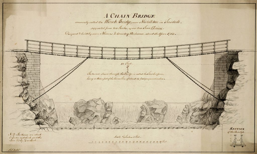
During the 18th century, lead mining grew, resulting in the construction in 1741 of the first bridge across the upper river, the Wynch Bridge near Bowlees. It was built by miners from Holwick so they could get to their work in the mines on the north side. The original bridge has been replaced and you can still cross it, getting great views of Low Force.
Hushes are a dramatic and very visible component of the lead mining industry. Gullies were dammed and then the water released, so that the torrent of water exposed ores. The Coldberry Gutter is a deep cut in the skyline, visible for many miles and is unusual in that it cuts through the watershed between neighbouring valleys. There is now some evidence from the AONB’s ‘Oresome’ project’s research that the gutter is primarily a channel formed by glacial meltwater, which miners exploited.
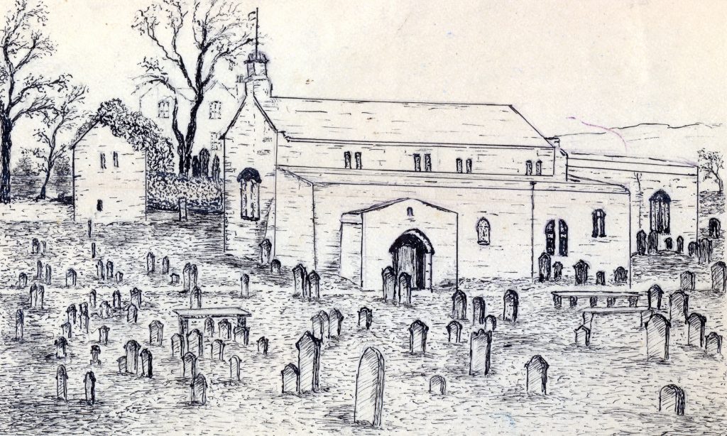
St. Mary’s in Middleton was the only church in the dale until 1724. Methodism spread and John Wesley preached here in 1780. The Methodist chapel in Newbiggin was the oldest in use in the world until it closed in 2017. St Mary’s has an historic bell tower containing three ancient bells. The tower is separate from the church and was built alongside the former medieval church on the site. The oldest bell is dated 1557. For more information about churches in Upper Teesdale see the Churches Together website.